services
services & ADD-ons
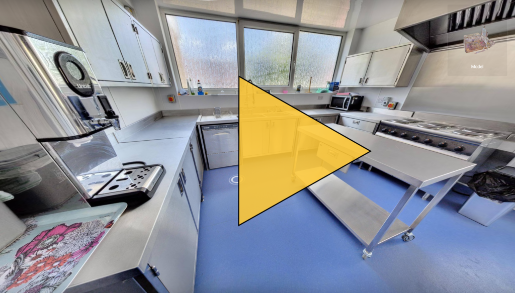
Virtual Tours
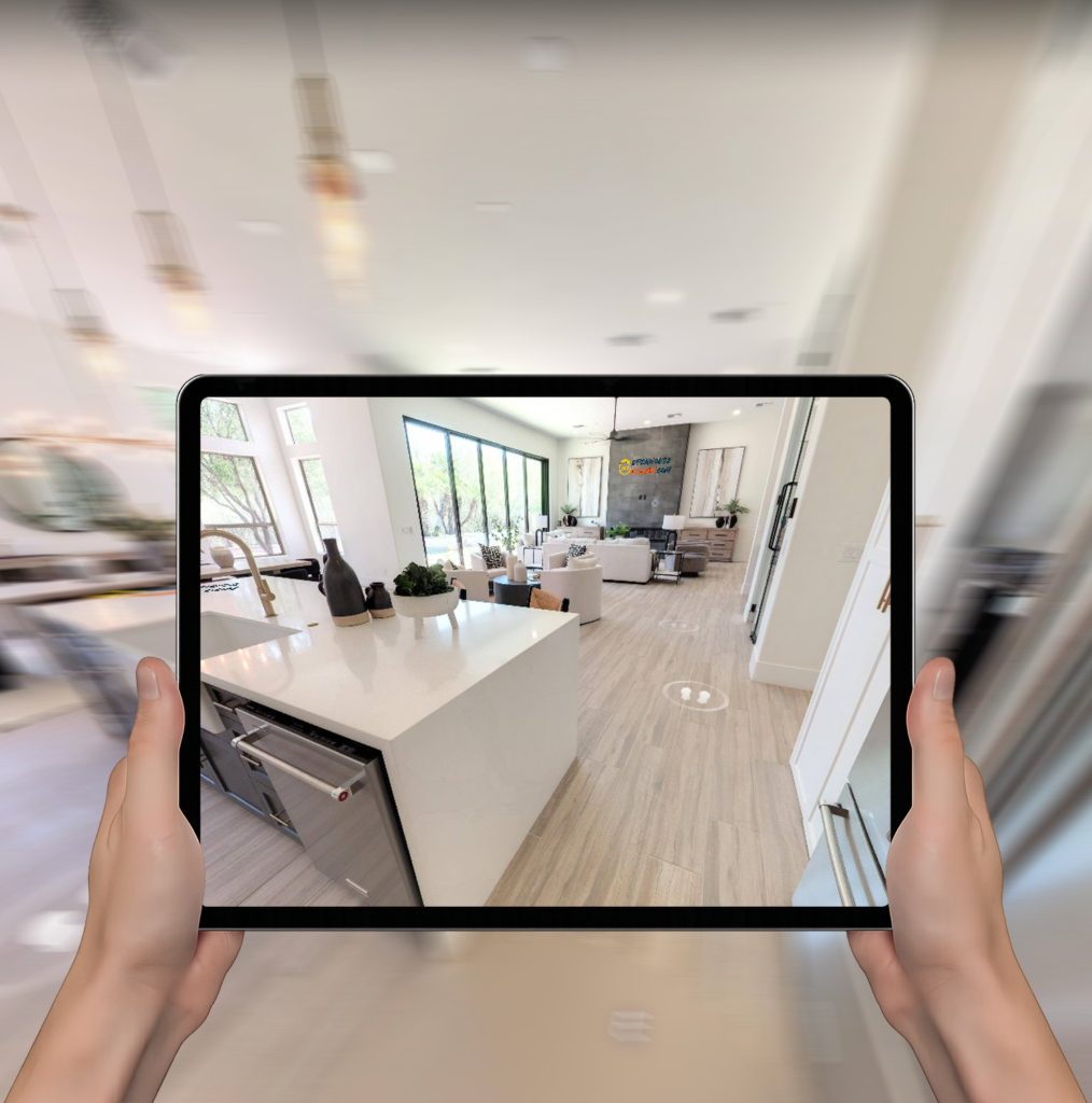
An interactive digital experience that lets clients explore a property or site remotely, as if they were physically there. It provides a realistic view of spaces, layout and condition, making it easier to inspect, present and understand an environment without needing an in-person visit.
A navigable visual walkthrough created from real-world imagery, giving users the freedom to look around and move through a space online. Clients can expect a clearer sense of scale, context and detail, along with a more efficient way to review sites, buildings and completed works.
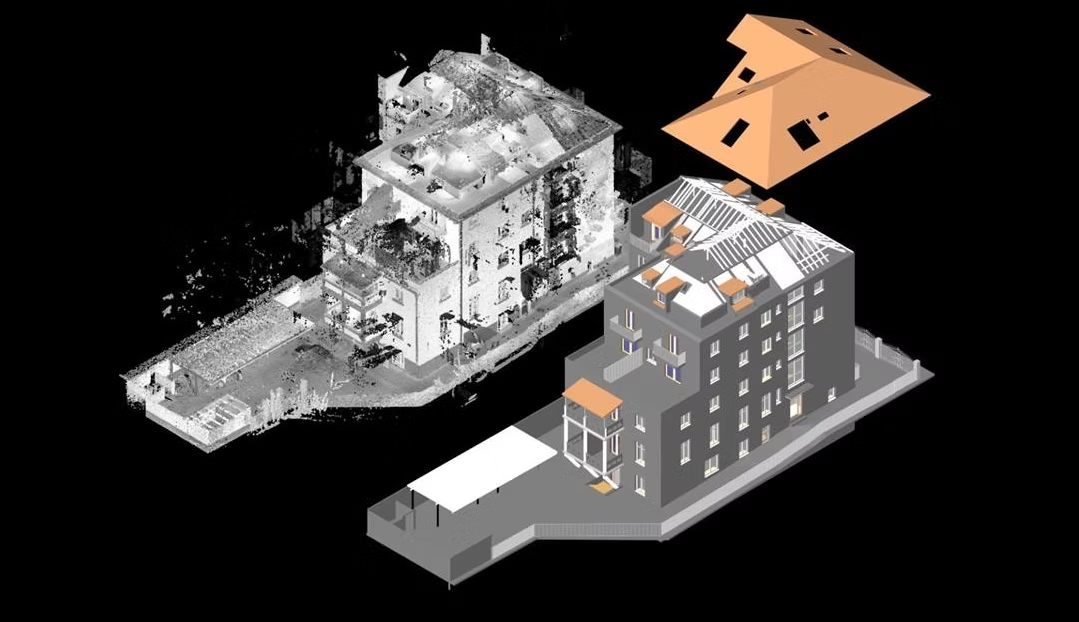
digital twins
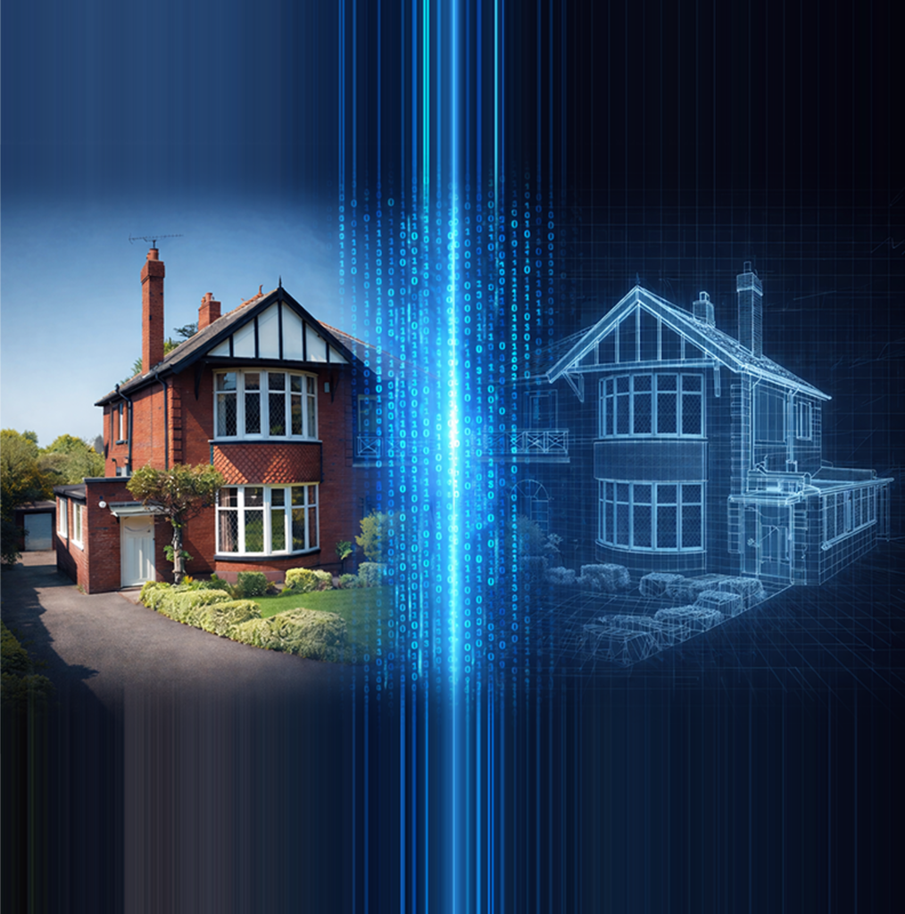
A dynamic digital replica of a real building or asset, bringing together geometry, condition, performance and operational data in one place. It gives clients a clearer, live view of their property so they can make faster, better-informed decisions about maintenance, compliance, performance and future investment.
A connected virtual version of your physical asset that mirrors how it is designed, built and operated. You can expect improved visibility, better planning, reduced risk and a smarter basis for managing the asset across its whole lifecycle.
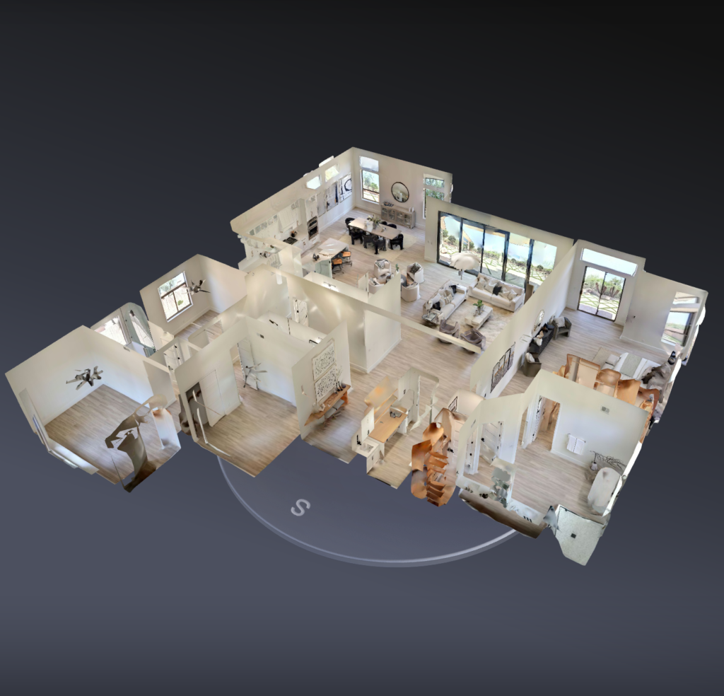
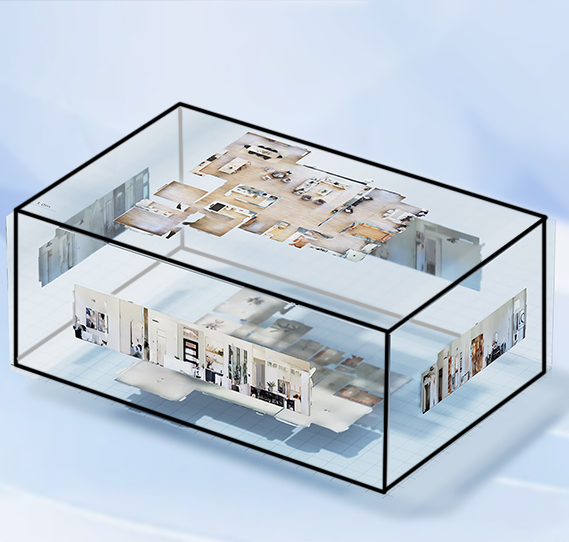
floor plans
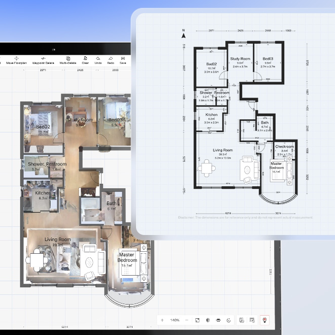
Professionally crafted, high precision, RICS compliant,
ready for marketing.
Floor plan with a powerful online editor, free to download and refine anytime.
a layout drawing generated from the same scan data used to build the virtual tour, combining panoramic capture with LiDAR-based spatial data. Clients can expect a fast, clear view of room layout, flow and spatial relationships, with the option to refine the plan further where needed.
Floor plans generated from a 360 virtual tour using Realsee Galois LiDAR provide a quick, clear and data-informed representation of a property’s layout, helping clients understand space, flow and configuration with greater confidence.
panorama file
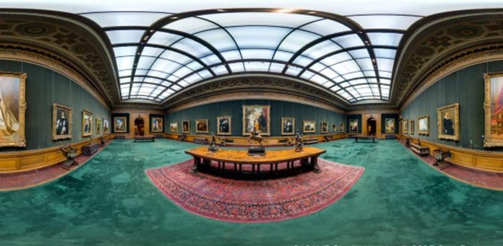
A panoramic image is a type of image that provides a wide-angle, all-encompassing view of a scene. It has a standard aspect ratio of 2:1 and is created by stitching together multiple images or video frames into a single plane, allowing viewers to freely explore and navigate the entire scene.
Panoramic images are widely used in virtual reality, real estate, and interior design, providing users an immersive visual experience.
space video
A Space Video is an AI-generated spatial navigation video based on
a VR project and its points. After generation, it can be further edited
for creative purposes. MP4 format
point cloud .e57 .ply .raW
Compared to the JPG format, the RAW format contains more information and offers greater flexibility for post-processing adjustments. It can be opened with professional software such as Lightroom and Photoshop. Generally, it is provided for photographers, designers, and others who have high demands for image quality.
Point Cloud is a digital representation used to represent objects or scenes in three-dimensional space. It is composed of a large number of points, each with a definite coordinate in three-dimensional space.
E57 and PLY format
model
Based on digital spatial capabilities, real spaces can be transformed into 3D models, which support exporting multiple formats and can be used by professionals in the construction industry, development, and design. The data formats provided for downloading models include OBJ, FBX, GLTF, and GLB, which are common 3D model file formats with specific purposes and characteristics.
Note: Depending on the model format and rendering platform, the display effect may vary. The actual effect is subject to the final downloaded product.
cube map
Cubemap is a technique widely used in computer graphics to simulate three-dimensional space. The cubemap images at each point are composed of six 2D textures, each corresponding to one of the six faces of a cube (top, bottom, left, right, front, back). By stitching these textures together, a complete three-dimensional environment can be created.
Live 3D Call
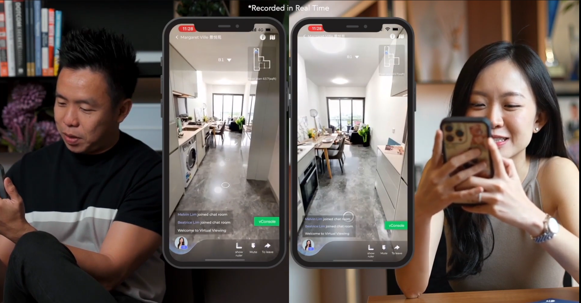
This function enables real-time voice communication between hosts and guests in 3D tours, allowing multiple people to explore and mark the space together, breaking geographical limitations and providing users with an immersive experience. This function can be easily initiated and shared from both the mobile app and the PC console.
Currently, the app only supports initiating and sharing, while the console supports initiating, sharing, and viewing historical records.